Subject: Colonial Eastern United States & Canada
Period: 1744 (published)
Publication:
Color: Black & White
Size:
8.5 x 10.6 inches
21.6 x 26.9 cm
This is the third volume of Charlevoix's Histoire et Description Generale de la Nouvelle France, an important account of French possessions in Colonial North America. Pierre Francois Xavier de Charlevoix was a Jesuit Priest who traveled through the French possessions of North America from 1720-1722. He brought manuscript sketches back to Paris and published an account of his travels with 28 maps and 44 botanical plates. The account is Charlevoix's largest historical work and is considered one of the best works on Canada, Louisiana, and French Florida of the time period. It was extremely influential in future decisions made by Thomas Jefferson with regard to the Louisiana Purchase and the exploration of the west. The text of the third volume chronicles the expedition over 36 letters dating from June 1720 to December 1722. It includes important maps by Bellin of the Great Lakes, Louisiana, Florida, and Quebec. The maps are dated 1744, and are engraved by Debruslins and Dheulland. There are 10 maps (all of them folding, except for the map of the Straits of Mackinac). The maps are:
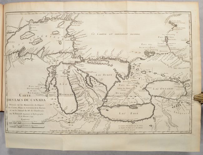
A. Carte des Lacs du Canada..., (18.4 x 11.4"). Possibly Bellin's most important map, it covers the entire Great Lakes region, depicting the river system, and identifying numerous forts, Indian tribes and place names. Most notably, this is the first map to introduce the fictitious islands of Philippeux, Pontchartrain, Maurepas, and St. Anne in Lake Superior. These spurious islands would continue to appear on maps for the next 50 years, including John Mitchell's important map in the following decade. Despite these erroneous additions and the spurious mountain range in Michigan, Bellin's map is still considered to be one of the most accurate of the time period. Reference: Kershaw #947; Tooley (MCC-96) #716; Karpinski p. 137.
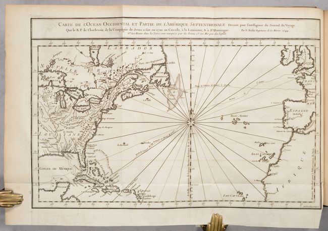
B. Carte de l'Ocean Occidental et Partie de l'Amerique Septentrionale, (15.0 x 9.8").
C.Carte du Cours de la Riviere du Saguenay Appellee par les Sauvages Pitchitaouichetz..., (11.3 x 7.9").
D. Carte de l'Isle d'Orleans et du Passage de la Traverse dans le Fleuve St. Laurent..., (10.9 x 7.5").
E. Plan du Bassin de Quebec et de ses Environs, (11.1 x 7.8").
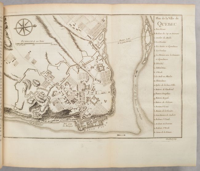
F. Plan de la Ville de Quebec, (11.3 x 7.7").
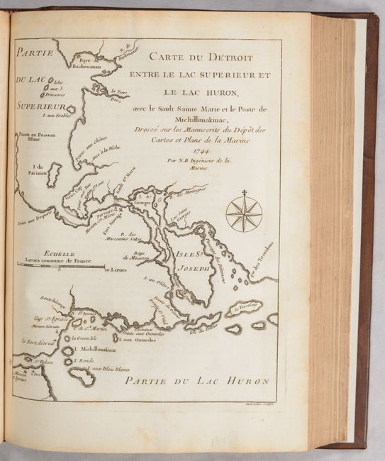
G. Carte du Detroit Entre le Lac Superieur et le Lac Huron..., (6.3 x 8.4").
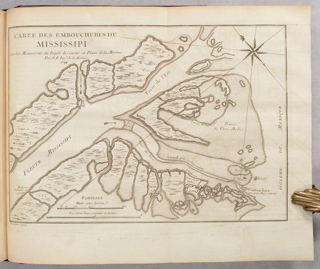
H. Carte des Embouchures du Mississipi..., (11.3 x 7.9").
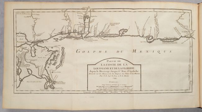
I. Partie de la Coste de la Louisiane et de la Floride Depuis le Mississipi Jusqua St. Marc d'Apalache..., (17.5 x 8.0").
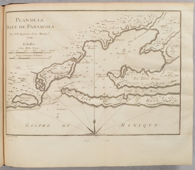
J. Plan de la Baye de Pansacola, (11.1 x 7.8").
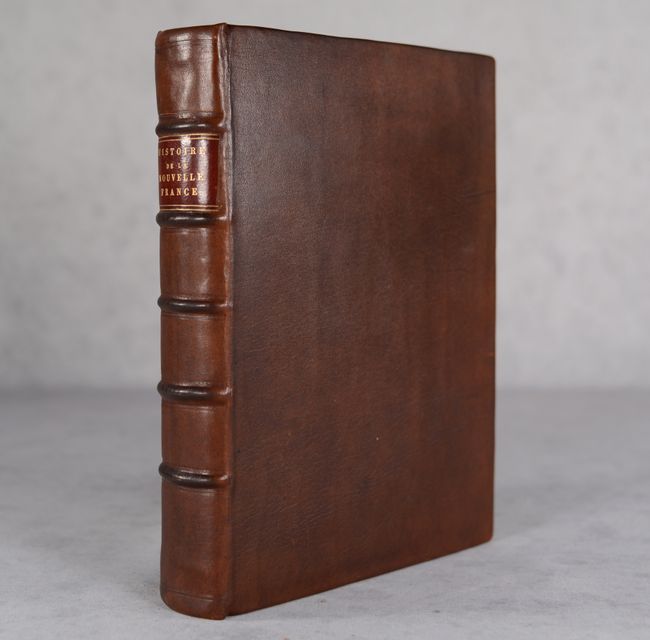
This work was published in six or seven different editions in 1744, including 3-volume quarto editions and 6-volume duodecimo editions; this is a quarto edition. 543 page, plus a 19-page note on the maps by Bellin and a 14-page table of contents. Attractively rebound in dark brown leather with raised bands and maroon title label on spine.
References: Howes #C-307; Sabin #12135; cf. Shirley (BL Atlases) G.CHAR-3a.
Condition: A
The maps are near fine with minor offsetting and marginal toning; the Great Lakes and North Atlantic maps have short binding tears that have been closed with archival tape on verso. The text has occasional foxing, passages underlined in manuscript ink, and marginal toning. The new leather binding is near fine with minimal wear.