Subject: United States & Canada
Period: 1804 (circa)
Publication:
Color: Hand Color
Size:
9.9 x 7.9 inches
25.1 x 20.1 cm
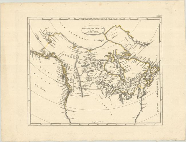
This is a French edition of Arrowsmith & Lewis' map of the same region. It encompasses all of Canada with a possible Northwest Passage via Baffin Bay to the Bering Strait marked as "doubtful." In the far north, the map notes that the sea was seen by Hearne and MacKenzie in 1771 and 1789 respectively. Numerous Indian tribes are located, along with rivers, lakes and the Stoney Mountains. In the northern United States, there are three possible sources for the Missouri River. Published in a French edition of John Pinkerton's Modern Geography.
References:
Condition: A
A crisp impression on a clean sheet with binding holes in the top blank margin.