Subject: Canada, Atlases
Period: 1929 (circa)
Publication:
Color: Printed Color
Size:
11.6 x 16 inches
29.5 x 40.6 cm
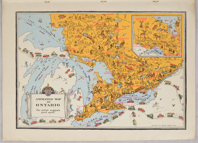
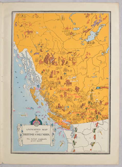
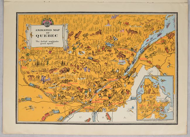
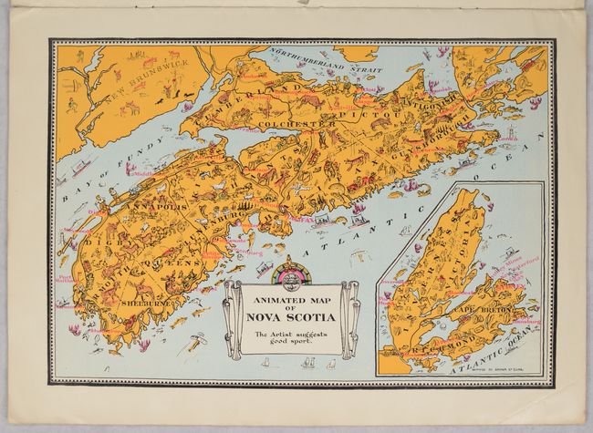
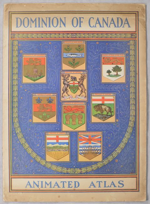
Issued by Canada's Department of the Interior and Natural Resources Intelligence Service, this charming pictorial atlas features 9 "animated maps" of the provinces by Arthur Edward Elias. The maps include Prince Edward Island, Nova Scotia, New Brunswick, Quebec, Ontario, Manitoba, Saskatchewan, Alberta, and British Columbia. Each map mixes illustrations of the province's natural resources with playful cartooning showing wildlife and the people of the region, often interacting with comical results. Accompanying text by Oliver Master emphasizes each province's natural resources and distinctive character. The illustrated paper covers are a work of art in their own right, with a lovely depiction of each province's coat of arms. Although the individual maps can be found for sale, this is the first time we have seen the complete atlas on the market.
References: Rumsey #1643.
Condition: B+
The maps are clean, bright and near fine (A). Paper covers are toned along the edges with a couple tears along the spine.