Subject: North America
Period: 1853 (dated)
Publication:
Color: Hand Color
Size:
26.1 x 21.5 inches
66.3 x 54.6 cm
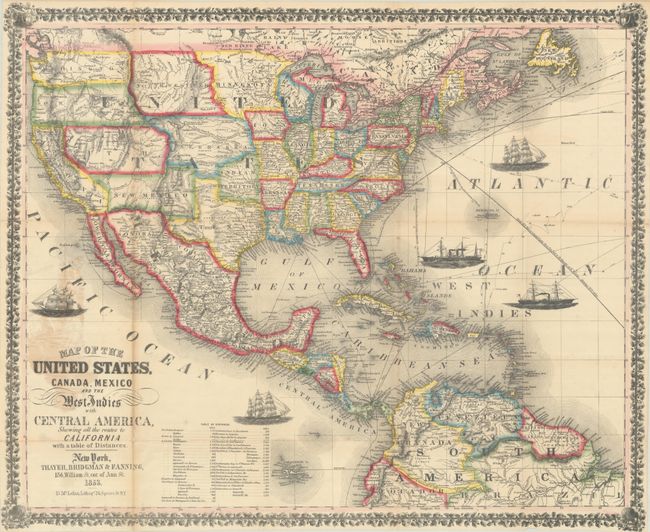
This pocket map was published near the end of the California Gold Rush and was created to show "all the routes to California." This was also a time when many territorial borders were in their most interesting configurations. Eight large territories make up the majority of the Western United States, which would later become 15 different states. These territories include Washington, Oregon, Northwest, Minnesota, Utah, New Mexico, Nebraska, and Indian Territory. The map is filled with many details including rivers, railroads, wagon roads and Indian tribes and extends to include portions of Canada, Central America, northern South America and all of the Caribbean islands. Sea routes between various ports are displayed along with 5 vignettes of sailboats and steamships in the oceans. A table listing distances between ports is located at bottom. Surrounded by a decorative border. Covers are no longer present. The Wheat reference is for an 1854 edition published by Ensign, Bridgman & Fanning.
References: cf. Wheat (TMW) #804; cf. Wheat (Gold) #258.
Condition: B+
Issued folding with a 10" and 5.5" fold separation at left that have been closed on verso with archival tape. There is some staining around the title where the map was previously glued to an inside cover.