Catalog Archive
Auction 207, Lot 94
"Amerique Septentrionale pour Servir a l'Instruction de la Jeunesse", Dufour, Auguste-Henri
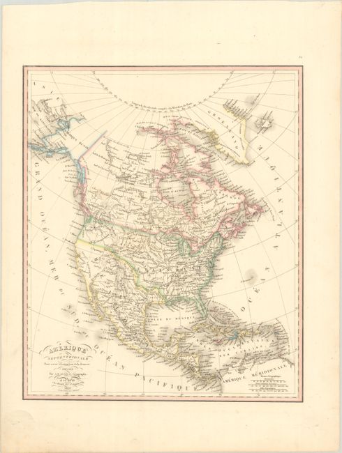
Subject: North America
Period: 1828 (dated)
Publication:
Color: Hand Color
Size:
13.8 x 16.4 inches
35.1 x 41.7 cm
Download High Resolution Image
(or just click on image to launch the Zoom viewer)
(or just click on image to launch the Zoom viewer)