Subject: North America
Period: 1796-1800 (circa)
Publication:
Color: Black & White
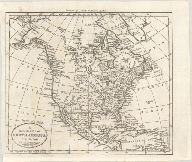
A. A General Map of North America from the Best Authorities, by (Rev.) Jedidiah Morse, circa 1796 (8.8 x 7.4"). This small map of North America shows a mostly blank Great Basin and a long River of the West extending from the Entrance of Juan de Fuca eastward nearly to the Mississippi River. The map has good watershed detail, locates the source of the Mississippi River, and names some Indian tribes, forts, etc. Texas is located within the huge Louisiana Territory, but not delineated. Other interesting place names in the West include Quivira, Tecuayo, and New Albion. Engraved by Amos Doolittle. Published by Thomas & Andrews, Boston. Reference: McCorkle (18th C. Geography Books) #304-2.
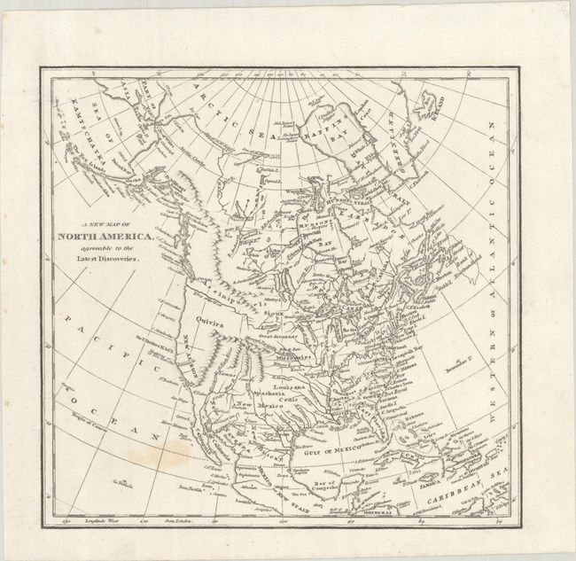
B. A New Map of North America, Agreeable to the Latest Discoveries, by Robert Wilkinson, circa 1800 (9.1 x 8.7"). This petite map of the continent presents the nascent United States confined to east of the Mississippi River. Florida is divided into East and West, and a prominent River of the West flows into the Pacific. The west coast is labeled New Albion with a few place names along the coast including Sir F. Drake's H. 1578. The interior is largely blank with the exception of some limited topography and the river systems including a note that states that the "Missouri Navigable 1300 Miles."
References:
Condition: B+
Issued folding and now flat with a few faint spots. The first map has some light offsetting.