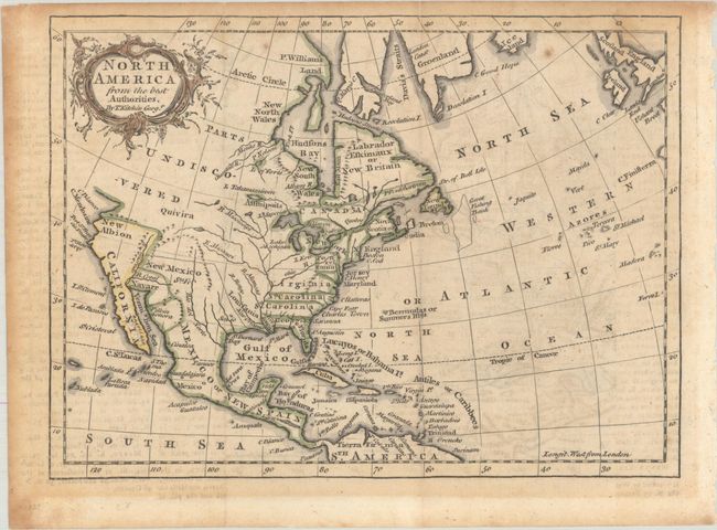
Subject: Colonial North America
Period: 1759 (published)
Publication: The Modern Gazetteer
Color: Hand Color
Size:
7.8 x 5.8 inches
19.8 x 14.7 cm
This small map of the continent shows the southern colonies of Virginia, North Carolina, South Carolina, and Georgia all extending to the Mississippi River. Spain is in control of the region to the west of the Mississippi River with only a few place names located including Senis in present-day Texas and Santa Fe. The Pacific Northwest is "Parts Undiscovered" and the coastline ends just above New Albion. The map extends through Central America to northern South America with good detail of the West Indies. Ireland and Britain are located along the top right border. Adorned by a rococo title cartouche. Published in Thomas Salmon's The Modern Gazetteer.
References: McCorkle (18th C. Geography Books) #335-5.
Condition: B
Issued folding, on a lightly toned sheet with light offsetting and a few small spots. The toning is darker along the top and left edges of the sheet.