Subject: Colonial North America
Period: 1699 (dated)
Publication: Atlas Novus
Color: Black & White
Size:
13.9 x 9 inches
35.3 x 22.9 cm
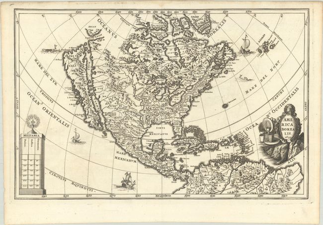
Henrich Scherer, a mathematics professor and Jesuit, produced this work to emphasize the extent of Catholic influence in the New World. The richly engraved map shows the island of California after the Sanson model with a large mountain range. The Great Lakes are prominently depicted and the Mississippi River originates in two large lakes in present-day Canada and empties into the Sinus Mexicanus too far to the west. The map is decorated with a title cartouche, distance scale, ships and sea monsters. The title cartouche is decorated with metal ware signifying the Spanish Empire's wealth derived from the gold and silver mines in the Americas.
References: Burden #756; Mickwitz & Miekkavaara #281-33; McLaughlin #128; Tooley (Amer) p. 131; Shirley (BL Atlases) T.SHER-1a #112.
Condition: A
A fine impression with a hint of offsetting. There is a faint dampstain in the top blank margin. Remnants of hinge tape on verso.