Subject: Western Hemisphere - America
Period: 1842 (dated)
Publication:
Color: Hand Color
Size:
29.1 x 20.9 inches
73.9 x 53.1 cm
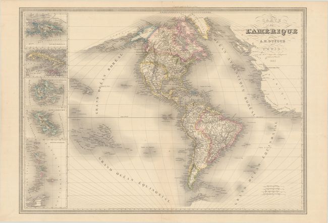
This large and striking map centers on the Americas and extends to includes portions of Europe, Africa and Asia. In North America, despite the 1842 date, Texas is named but still a part of Mexico. The Great Basin is noted as Partie Inconnue with several spurious rivers flowing over the Sierra Nevadas to the Pacific Ocean including the R. S. Sacramento and the R. S. Buenaventura. In the Pacific Northwest, U.S. claims extend well into present-day British Columbia. The interior region consists of Indian tribes, rivers and several forts. In South America, the river systems, topography, and coastal place names are well developed. Insets of various Caribbean islands flank the map at left. Surrounded by a keyboard-style border.
References:
Condition: A
Contemporary outline color with a few faint spots. Short centerfold separations at top and bottom have been archivally repaired on verso.