Subject: References, Ortelius, Vrients, & Galle
Period: 1999 (published)
Publication:
Color: Black & White
Size:
22.3 x 16.2 inches
56.6 x 41.1 cm
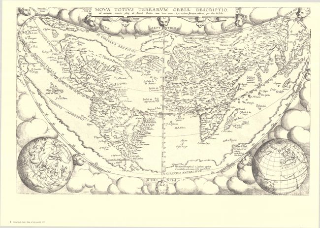
This is the second volume in this incredible series on the history of cartography. Volume II primarily focuses on three mapmakers in 16th-century Antwerp: Ortelius, Joan Baptista Vrients, and the Galle family. The book's four sections cover the Ortelius world map of 1564, his wall map of Asia (1567), the Ortelius-Clusius wall map of Spain (1571), and the Vrients' wall map of the Seventeen Provinces, with their various editions and derivatives. Text volume in both Dutch and English, 171 pp., profusely illustrated, together with the portfolio containing full-size facsimile reproductions of 9 maps on 45 sheets. The maps reproduced in the portfolio are the Ortelius wall map of the world (8 sheets); the de Jode folio version (1 sheet); the Ortelius wall map of Asia (8 sheets); the Ortelius-Clusius wall map of Spain (6 sheets); the Galle-Vrients wall map of the Seventeen Provinces (16 sheets); the Galle map of the Central Netherlands (3 sheets); the folio version of the Seventeen Provinces map (1 sheet); the Joannes en Baptista van Deutecum folio version (1 sheet); and the Frederick de Wit folio versio (1 sheet). Hardbound in blue cloth with gilt embossed titles.
References:
Condition: A
The facsimile maps are crisp and clean, with some slightly creased corners. Covers have a touch of soil and the corners are slightly bumped on the portfolio.