Subject: School Atlases
Period: 1839 (published)
Publication:
Color: Hand Color
Size:
9.9 x 12.3 inches
25.1 x 31.2 cm
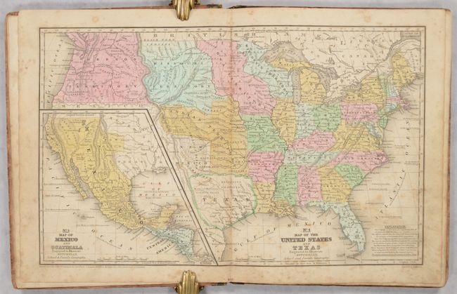
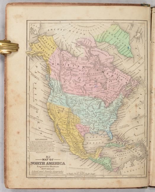
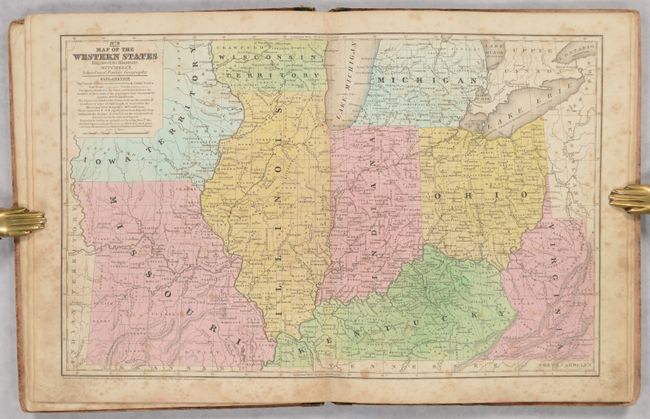
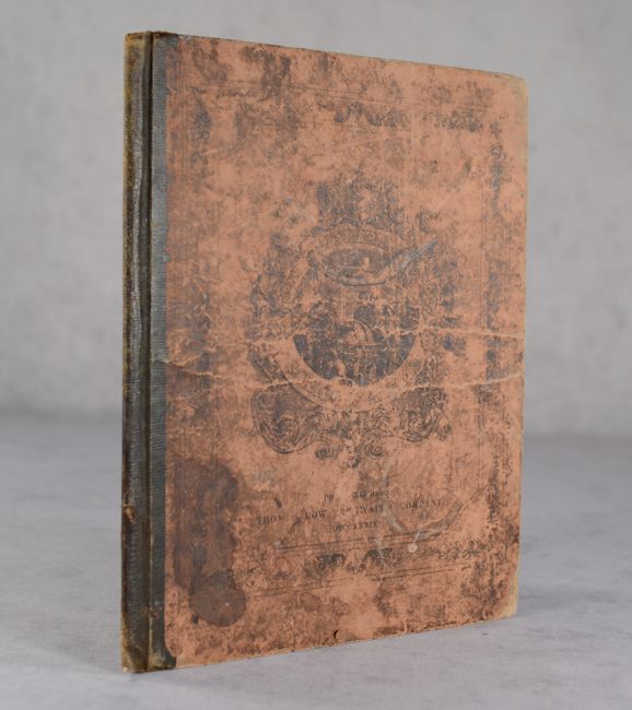
This is the complete first edition, first issue, of Mitchell’s famous school atlas. It includes 8 single-page and 4 double-page maps along with tables and statistics. All of the maps are dated 1839. The Republic of Texas is depicted in its smaller configuration along the Nueces River and can be seen on both the maps of North America and United States, which further notes "Herds of Buffaloes and Wild Horses" and "Extensive Prairies" in Texas. On this same map, Oregon Territory fills the Northwest and extends well into present-day British Columbia reflecting the ongoing boundary dispute with Britain. The Map of the Western States features an early depiction of Iowa Territory. Table of contents is located on the rear cover. Hardbound with pictorial paper over boards.
References:
Condition: B
The maps have soiling, foxing, and occasional colored pencil notations. The covers are heavily worn and stained.