Subject: Western Hemisphere - America
Period: 1684 (circa)
Publication: Beschreibung des Gantzen Welt-Kreisses...
Color: Hand Color
Size:
4 x 5.6 inches
10.2 x 14.2 cm
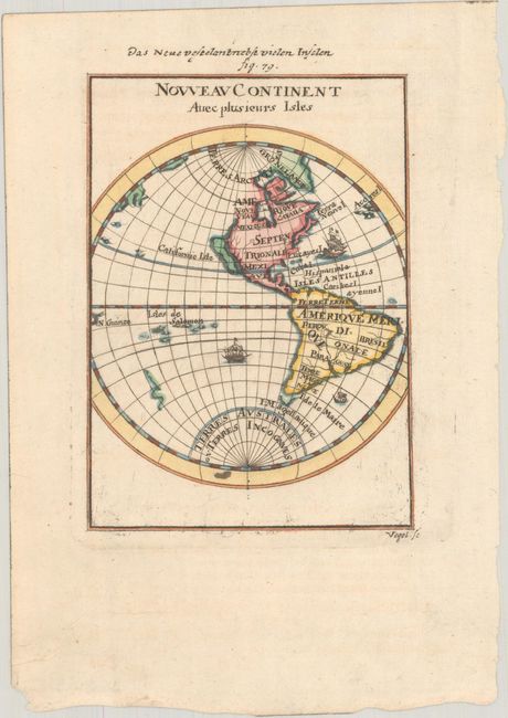
This is the re-engraved edition of this charming miniature map drawn in a hemispheric projection. California is depicted as an island on the Briggs model, with a flat northern coast. The Solomon Islands dominate the Pacific, and part of the New Zealand coast is shown but not named. Three small galleons decorate the map. This map was first published by Mallet in 1683, and then re-engraved for a German edition in 1684 published by Johann David Zunners. Titled above in German: Das Neue Veste Land Nebst Vielen Inseln with Fig. 79.
References: Burden #595; McLaughlin #84-1; Pastoureau, MANESSON-MALLET I B.
Condition: A
A sharp impression with a small ink stain in the bottom portion of the image.