Subject: Western Africa
Period: 1675 (circa)
Publication:
Color: Hand Color
Size:
19.9 x 16.4 inches
50.5 x 41.7 cm
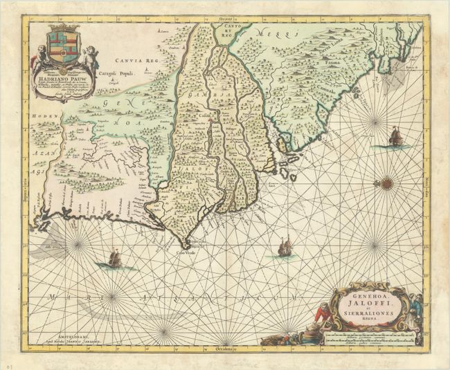
This decorative chart shows the coastline of present-day Senegal, Gambia, and Guinea-Bissau. The primary focus of the chart are the main rivers in the region, including the Senegal, the Gambia, the Casamance, and the Rio Grande de Buba. These waterways were important for trade in the region. The title notes the regions of Genehoa, Jaloffi, and Sierra Leone, which are each noted on the map. The name Genehoa relates to the influence of gold merchants from Genoa, Italy at the time. Jaloffi denotes the Jolof Empire, which had encompassed much of Senegal from the 14th to 16th centuries, but had been largely reduced by the time this map was published.
Only a few cities are noted on the map, and the interior is filled with tiny trees and mountains. The map is dedicated to Hadrianus Pauw in a lovely cartouche at top left with a coat of arms and a pair of cupids. The map is further embellished with three sailing ships, a compass rose orienting north to the left, and a decorative title cartouche featuring trade goods. Blank verso.
References: Van der Krogt (Vol. I) #8710:1.
Condition: B+
A sharp impression with full contemporary color on a bright sheet. There are a few faint stains in the image and professional repairs to a number of chips and tears along the edges of the sheet, with several short tears entering the image at far right.