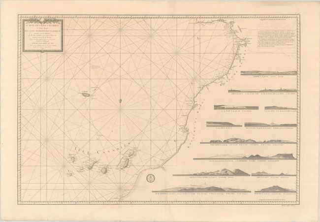
Subject: Northwestern Africa & Canary Islands
Period: 1780 (dated)
Publication:
Color: Black & White
Size:
33.8 x 22.8 inches
85.9 x 57.9 cm
This wall-sized map focuses on the coastline of Africa from the Strait of Gibraltar to Boujdour in present-day Western Sahara, and extends to include the Canary Islands. The interior of Africa is filled with twelve coastal land approach views. It identifies a number of place names and depth soundings along the coast of Africa. The map is based on observations made by Chevalier Charles de Borda aboard the Boussole in 1776. Engraved by Petit. The engraved seal of the Depot de la Marine is at bottom center and the price, "Prix Deux Francs," is at bottom right.
References: Rumsey #15934.298.
Condition: B+
A crisp impression on a lightly toned sheet with two "D J" watermarks, a faint dampstain at bottom center, and a couple of short tears at bottom that have been archivally repaired.