Subject: Northern Africa
Period: 1595 (published)
Publication: Theatrum Orbis Terrarum
Color: Hand Color
Size:
19.8 x 13 inches
50.3 x 33 cm
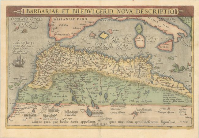
Handsome map of the famed Barbary coast based on Gastaldi's Africa. The map extends from Morocco to Libya and the western Mediterranean showing the proximity of the Balearic Islands, Corsica, Sardinia, southern Italy and Sicily. Richly engraved with place names, mountains, and numerous spurious lakes in the Sahara Desert. The title is contained in a strapwork panel across the top. Two fantastic sea monsters and a sailing ship ornament the map. This is the second state, with Latin text on verso.
References: Van den Broecke #176.
Condition: B+
A nice impression with full contemporary color on a sheet with a coat of arms watermark, light toning along the centerfold, a minor abrasion at bottom left, and a worm track along the centerfold at bottom that has been professionally repaired with a small amount of the image replaced in facsimile. There are remnants of paper tape along the top edge of the sheet on verso.