Subject: Africa
Period: 1781 (dated)
Publication:
Color: Hand Color
Size:
25.4 x 19.8 inches
64.5 x 50.3 cm
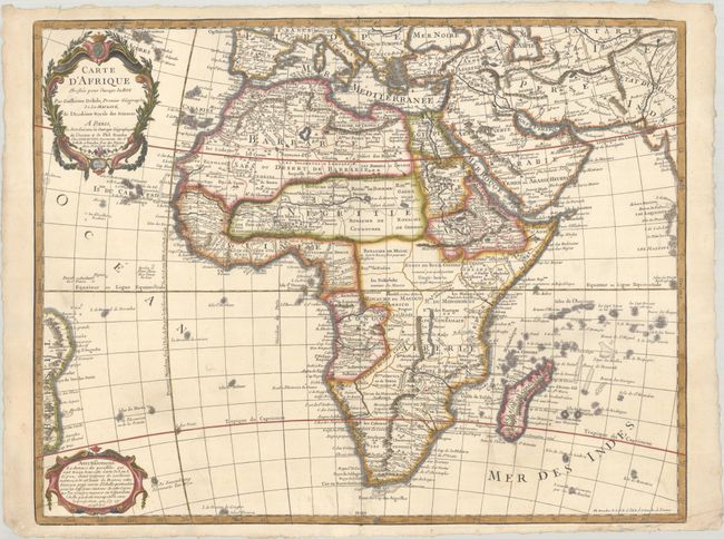
This is a later edition of Delisle's 1722 map of the continent and Madagascar detailing all of Africa, divided into kingdoms and tribes. It correctly shows the Senegal and Niger rivers as separate entities. In the southeastern portion of the continent Lake Moravi is shown well inland from Zanzibar. Two decorative cartouches grace the map along the left border. Dezauche was Buache's son-in-law, and the successor to the Delisle business.
References: cf. Norwich #78.
Condition: A
A crisp impression on a bright, sturdy sheet with deckled edges, and an "IHS" watermark, and minor soiling in the image. There are a couple of creases in the bottom corners of the sheet and light soiling along the edges.