Subject: Southern & Southeast Asia
Period: 1676 (circa)
Publication: Introductionis in Universam Geographiam
Color: Hand Color
Size:
10.2 x 7.3 inches
25.9 x 18.5 cm
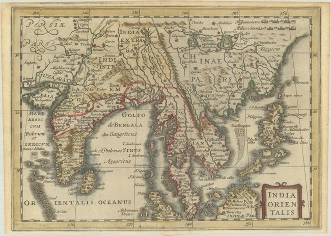
This is a reduced version of Jodocus Hondius' folio map of South East Asia. It covers the region from India through southern China and the Philippines including all of the Malay peninsula with parts of northern Sumatra and Borneo. The Gulf of Cambay is very exaggerated. The mythical Caiemai Lacus appears northeast of India, along with two large lakes in China. Blank verso.
This map was published by Jan Jansson's heirs in an edition of Cluver's Introductio in Universam Geographicam, which included some maps from Jansson's Atlas Minor. Cluver's Introductio in Universam Geographicam was a popular atlas, appearing in over 45 editions during a 100-year period. The first edition was published without maps in the 1620s, and the first edition to include maps was published circa 1641. The various editions were published in different cities throughout Europe, including Amsterdam, Nuremberg, and London, often with new sets of maps engraved.
References: Shirley (BL Atlases) T.CLUV-6a #36; Van der Krogt (Vol. III) #8400:353.1.
Condition: A
A nice impression with narrow margins and light toning along the edges of the sheet.