Subject: East Indies - Indonesia
Period: 1780 (circa)
Publication: Atlas de Toutes les Parties Connues du Globe Terrestre
Color: Hand Color
Size:
12.6 x 8.5 inches
32 x 21.6 cm
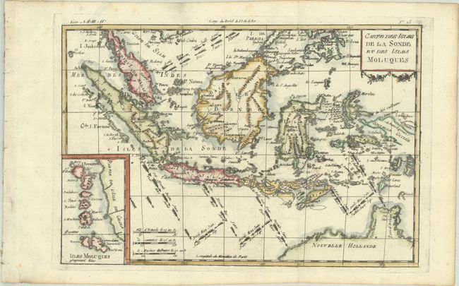
Great little map focused on the islands of Java, Sumatra, Celebes, Borneo, New Guinea as well as the tip of Australia's northern coast named as both Terre de Diemen and Terre d'Arnheim. Jakarta is Batavia and the engraver has placed Palembang in northern Java, hundreds of miles south of its actual location in Sumatra. Interesting notations depict the directions of the winds during the various months of the year. There is an inset map of the Moluccan Islands - the famous Spice Islands. The map has a rectangular title cartouche and three distance scales.
Rigobert Bonne was an important French cartographer of the late 18th century. In 1773 he succeeded Jacques Bellin as the royal cartographer in the office of the Hydrographer at the Depot de la Marine. Working in his official capacity, Bonne compiled some of the most detailed and accurate maps of the period.
References:
Condition: A
A dark impression, issued folding on a bright sheet with a fleur-de-lis watermark, binding holes along the left edge of the sheet, a couple of tiny spots, and minor toning along the edges of the sheet.