Subject: Southeast Asia & China
Period: 1708 (circa)
Publication:
Color: Hand Color
Size:
19.4 x 21.5 inches
49.3 x 54.6 cm
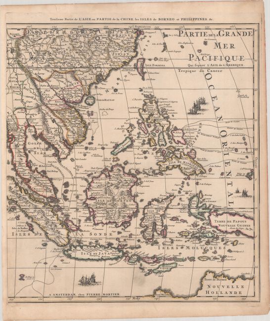
This scarce map of Southeast Asia and China was conceived as the southeastern sheet of a four-sheet wall map of Asia, however it was most commonly issued as a single sheet within Pierre Mortier's atlases, including his Atlas Nouveau. The map is centered approximately on the Philippines, which are still quite rudimentary in both shape and any knowledge of the interior of the islands. The routes of various explorations to the Philippines are noted, such as those of Juan Gaetan, who was a member of the 1542 Ruy López de Villalobos expedition in the Pacific, and Olivier van Noort's expedition in 1600. The trade routes taken to reach Siam (Thailand) are also shown. The map extends to include the northern part of Australia and parts of China. The map is embellished with several sailing galleons. This is the first state, with Pierre Mortier's imprint.
References: Koeman, Mor 1, Vol. II #95; Rumsey #12178.204.
Condition: A
A dark impression with contemporary outline color on a faintly toned sheet with a bit of printer's ink residue at bottom center and light toning along the edge of the sheet.