Subject: Japan & Korea
Period: 1607 (circa)
Publication: Gerardi Mercatoris - Atlas sive Cosmographicae
Color: Hand Color
Size:
17.6 x 13.5 inches
44.7 x 34.3 cm
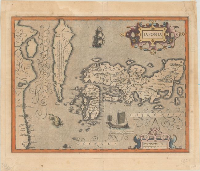
Superb map of Japan based on the Ortelius/Teixeira model with Honshu, Kyushu, and Shikoku depicted with approximately the correct proportions. Korea is shown as an island, although Hondius added a notation to the effect that is was uncertain if the region was an island or a peninsula. The map is richly ornamented with two strapwork cartouches, a European and Japanese ship, and a sea monster. Hondius engraved this map for inclusion in his edition of Mercator's atlas after he acquired Mercator's plates. It appeared in the editions of Atlas Sive Cosmographia from 1606 to 1636. Latin text on verso, published between 1607-08.
References: Hubbard #13; Walter #22; Van der Krogt (Vol. I) #8450:1A.1.
Condition: B
A lightly toned sheet with the coat of arms watermark of Marten Orges, a printer's crease adjacent to the centerfold, and scattered foxing. There are extraneous creases confined to the blank margins and an archivally repaired chip in the top right corner of the sheet, not affecting the image.