Catalog Archive
Auction 207, Lot 608
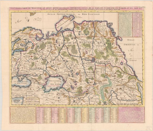
"Nouvelle Carte de Moscovie ou sont Representes les Diferents Etats de sa Maieste Czarienne en Europe et en Asie et le Chemin d'un de ses Ambassadeurs a Peking Ville Capitale de l'Empereur de la Chine et son Sejour Ordinaire", Chatelain, Henry Abraham
Subject: Northern Asia
Period: 1714 (published)
Publication: Atlas Historique, Tome IV
Color: Hand Color
Size:
22.9 x 19.8 inches
58.2 x 50.3 cm
Download High Resolution Image
(or just click on image to launch the Zoom viewer)
(or just click on image to launch the Zoom viewer)