Subject: Middle East, Egypt & Cyprus
Period: 1803 (published)
Publication: The Chronology and History of the World
Color: Black & White
Size:
22.6 x 16.6 inches
57.4 x 42.2 cm
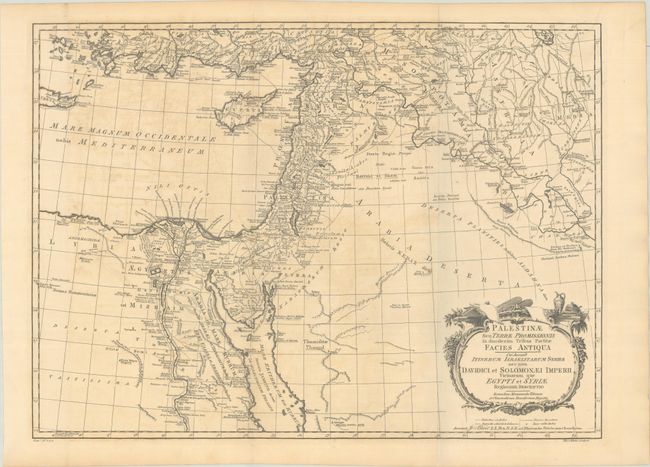
A highly detailed ancient map centered on the Holy Land and divided among the twelve tribes. It extends from present-day Turkey, Cyprus, and Egypt east to Iraq and Arabia. The map depicts mountains, rivers, lakes, travel and trade routes, and innumerable cities, villages, and other place names. Many ancient names are accompanied by more recent names placed below with special underlining. Adorned by a decorative strapwork title cartouche. Engraved by Thomas Kitchin.
Blair's Chronology went through many editions well into the 19th century with maps added in the 1768 and later editions to help illustrate lands covered by the work, both ancient and modern. Through the years, most maps show little or no revision between the various editions.
References: Laor #108; cf. Shirley (BL Atlases) G.BLAI-1a #2.
Condition: B+
Issued folding on a sheet with "J Ruse" and Strasbourg Lily watermarks. There is some light offsetting and a tiny hole in a blank area of the Arabian Desert.