Catalog Archive
Auction 207, Lot 563
Gorgeous, Large-Scale Folding Map of Rome
"Pianta della Citta di Roma con la Indicazione di Tutte le Antichita e Nuovi Abbellimenti", Monaldini, Venanzio
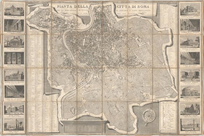
Subject: Rome, Italy
Period: 1827 (dated)
Publication:
Color: Black & White
Size:
44 x 29.4 inches
111.8 x 74.7 cm
Download High Resolution Image
(or just click on image to launch the Zoom viewer)
(or just click on image to launch the Zoom viewer)