Subject: Italy
Period: 1676 (published)
Publication: Introductionis in Universam Geographiam
Color: Hand Color
Size:
9.7 x 6.9 inches
24.6 x 17.5 cm
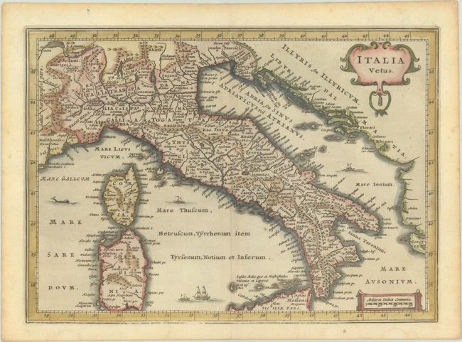
This uncommon small map of ancient Italy is filled with historical place names. It includes all of Corsica and Sardinia and the northern part of Sicily. The map is adorned with sailing ships, a sea monster, and two decorative cartouches.
This map was engraved for Jodocus Hondius Jr.'s atlas of Italy, which was published in 1626 and 1627. The map was later used by Jan Jansson's heirs in an edition of Cluver's Introductio in Universam Geographicam in 1676. Cluver's Introductio in Universam Geographicam was a popular atlas, appearing in over 45 editions during a 100-year period. The first edition was published without maps in the 1620s, and the first edition to include maps was published circa 1641. The various editions were published in different cities throughout Europe, including Amsterdam, Nuremberg, and London, often with new sets of maps engraved.
References: Shirley (BL Atlases) T.CLUV-6a #19; Van der Krogt (Vol. III) #7000H:372.
Condition: A
A crisp impression that has some weakness only in the bottom border. There is light toning and foxing along the edges of the sheet.