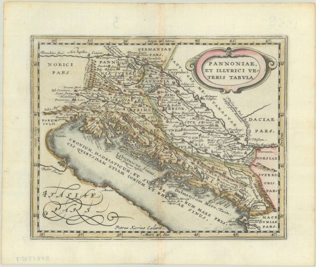
Subject: Western Balkans
Period: 1676 (published)
Publication: Introductionis in Universam Geographiam
Color: Hand Color
Size:
7.8 x 6.1 inches
19.8 x 15.5 cm
Attractive historical map of the Dalmatian coast from Italy to Greece. The map is derived from Ortelius' map of the same title, which was based on Gastaldi's map of southeast Europe (1560) and other information from ancient sources. Decorated with an oval strapwork title cartouche. Engraved by Petrus Kaerius.
Cluver's Introductio in Universam Geographicam was a popular atlas, appearing in over 45 editions during a 100-year period. The first edition was published without maps in the 1620s, and the first edition to include maps was published circa 1641. The various editions were published in different cities throughout Europe, including Amsterdam, Nuremberg, and London, often with new sets of maps engraved. This map is from an Amsterdam edition published by Jansson's heirs, which included some maps from Jansson's Atlas Minor.
References: Shirley (BL Atlases) T.CLUV-6a #25.
Condition: A
A crisp impression on a bright sheet with a hint of toning along the centerfold and edges of the sheet.