Catalog Archive
Auction 207, Lot 538

"Imperium Russiae Magnae Juxta Recentissimas Observat. Mappa Geographica Accuratissime Delineatum", Seutter/Lotter

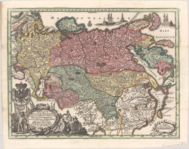
Subject: Russia in Europe

Period: 1744 (circa)

Publication:

Color: Hand Color

Size:
10.3 x 7.8 inches
26.2 x 19.8 cm
Download High Resolution Image
(or just click on image to launch the Zoom viewer)

A small but very detailed map depicting the Russian Empire and covering the region from Norway to a portion of Japan, including China, Korea, and the northern part of India. It is filled with place names, and even includes nomadic tent encampments in Mongolia. The Kamchatka Peninsula is presented in a bulbous shape owing to the lack of geographic information about the region. The map is adorned by a decorative title cartouche topped with the double-headed eagle of the Russian Empire.

References:

Condition: A

A sharp impression with full contemporary color on a sheet that was issued folding to fit in a small pocket atlas, and has now been pressed flat. Small remnants of hinge tape on verso.

Estimate: $150 - $180

Sold for: $75

Closed on 2/11/2026

Archived