Subject: Eastern Europe, Poland
Period: 1845 (circa)
Publication:
Color: Hand Color
Size:
21.8 x 18.1 inches
55.4 x 46 cm
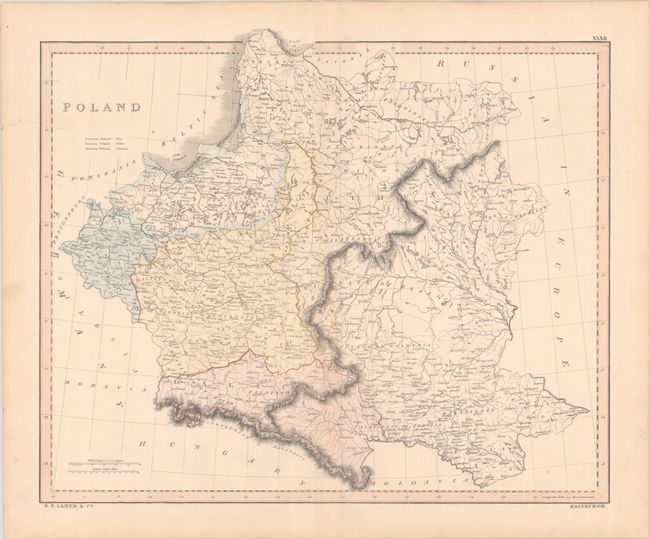
This scarce map was published by B.F. Lloyd & Co. of Edinburgh. It shows Poland as it was divided after the Third Partition of Poland in 1795. Prussian Poland appears in blue, Russian Poland in yellow, and Austrian Poland (under the control of the Habsburg monarchy) is "crimson." Palatinates are delineated as well. A slightly different edition of this map appeared in Gall & Inglis's The Edinburgh Imperial Atlas, Ancient and Modern (ca. 1850).
References:
Condition: B+
A nice impression with contemporary color with light spots and minor toning along the centerfold. Edge tears that just enter the border at left and right have been archivally repaired on verso.