Subject: Western Germany
Period: 1716 (published)
Publication:
Color: Hand Color
Size:
19.1 x 21.9 inches
48.5 x 55.6 cm
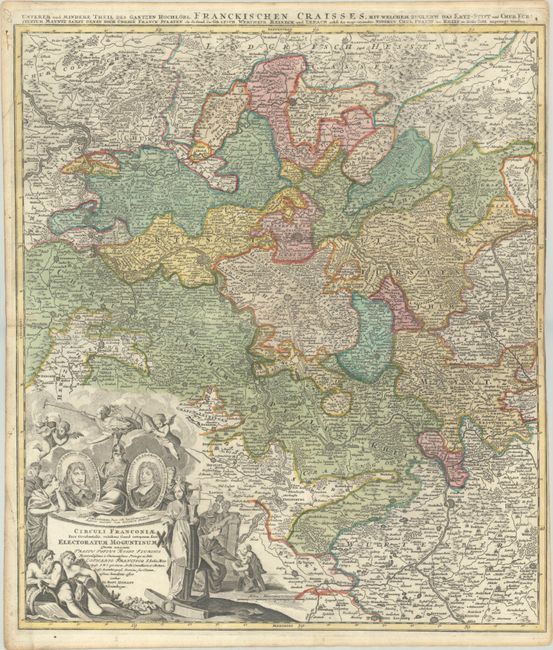
A striking regional map of western Germany, centered on Frankfurt, Darmstatt, Maintz and Heidelberg, and also shows Stuttgart, Heilbron, Wertheim, and Coblentz. The map is centered on Die Berg Strass or mountain route from Darmstadt to Heidelberg, a popular tourist tour today - via autobahn. There is remarkable detail of roads, rivers, lakes, mountains, towns, and fortified cities. The large decorative cartouche features medallion portraits of Joannes Philip and Lotharius Franciscus, putti, river gods, and other allegorical figures.
References:
Condition: B+
A crisp impression with full contemporary color on a bright sheet with a very small hole near the center of the image and a short tear at right. There is marginal soiling and a portion of the right margin has been trimmed to the neatline by the bookbinder.