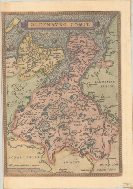
Subject: Northern Germany
Period: 1584 (circa)
Publication: Theatrum Orbis Terrarum
Color: Hand Color
Size:
9.8 x 13.5 inches
24.9 x 34.3 cm
This map depicts a portion of Lower Saxony based on the work of Laurens Michaelis, whose imprint appears at bottom right. The map is centered on Oldenburg with excellent detail of the extensive network of rivers. Embellishments include several sea monsters, sailing ships, and a moire patterned sea. This is the right-hand map from a sheet that included two maps, however the map of Denmark has been trimmed from the sheet. Blank verso. This map is less common than Ortelius' other maps as it only appeared in the Theatrum between 1584-98.
References: Van den Broecke #85.
Condition: B+
A nice impression on a sturdy sheet with the coat of arms watermark of Claude Denise and a narrow left margin. There is paper tape along the edges of the map on verso.