Subject: Central Europe, Germany, World War II
Period: 1946 (circa)
Publication:
Color: Printed Color
Size:
14.6 x 20.8 inches
37.1 x 52.8 cm
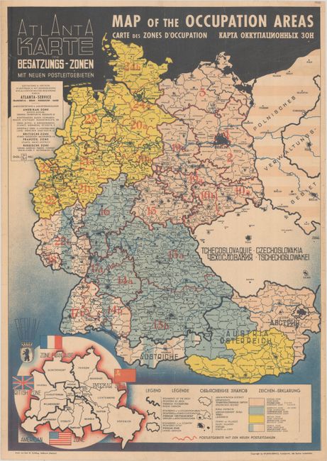
This map was issued by the Atlanta Service following the defeat of Nazi Germany in World War II. It presents Germany and Austria divided into occupation zones and is color-coded to indicate areas of control including British (yellow), Soviet Union (pink), American (blue) and French (blue/white/red). Each of these countries had complete political and legal authority in its respective zone. Berlin, despite being in the Russian zone, was also divided among the four powers given it was the former capital. To the east of Berlin, Poland's borders were extended west to the Oder-Neisse line, gaining former East Prussia, Silesia, and Pomerania. The map has text in four languages and was printed by Karl W. Schilling.
References:
Condition: B+
A colorful example, issued folding and now flat. There are several small edge tears at left and right that have been archivally repaired on verso.