Subject: Eastern Spain
Period: 1638 (circa)
Publication: Newer Atlas
Color: Hand Color
Size:
18.8 x 13.9 inches
47.8 x 35.3 cm
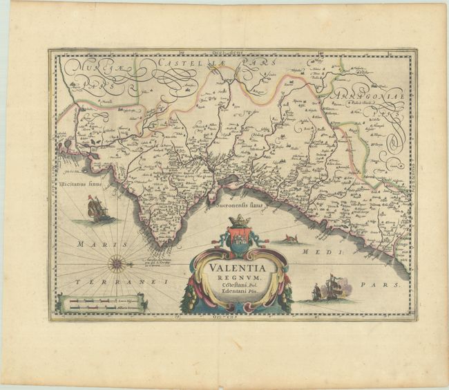
A handsome map of Valencia detailing the area from the Cenia River to St. Gines and inland to Murcia and Teruel. The map has numerous place names with pictorial depictions of cities and towns. The sea is filled with galleons, a sea monster and a fine compass rose. The decorative cartouche is topped with the coat of arms of the region, featuring a miniature view of the city of Valencia. German text on verso, published between 1638-42.
References: Van der Krogt (Vol. I) #6155:12.
Condition: A
A sharp impression with full contemporary color on a bright sheet with a printer's crease at top center and light toning and soiling along the edges of the sheet.