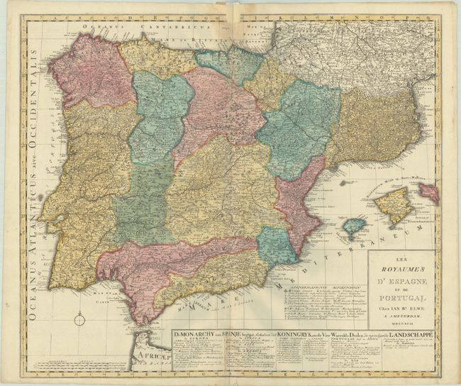
Subject: Spain & Portugal
Period: 1792 (dated)
Publication:
Color: Hand Color
Size:
23 x 19.9 inches
58.4 x 50.5 cm
This sharply engraved map of the Iberian Peninsula is filled with detail of towns, roads, and topography. The islands of Ibiza, Majorca and Minorca are included as well. The symbols used to indicate roads, rivers, monasteries, convents, Inquisition locations and other interesting places are noted in a key to the left of the cartouche. A band of text at the bottom notes the range of the Spanish and Portuguese colonial possessions in the New and Old Worlds.
References:
Condition: B
A crisp impression with full contemporary color on a bright sheet with a pair of elephant watermarks. There are light dampstains along the centerfold at top and bottom, with a chip at top center that has been archivally repaired, with loss of about 1" of the border.