Subject: Spain & Portugal
Period: 1626 (dated)
Publication: A Prospect of the Most Famous Parts of the World…
Color: Hand Color
Size:
21 x 16.3 inches
53.3 x 41.4 cm
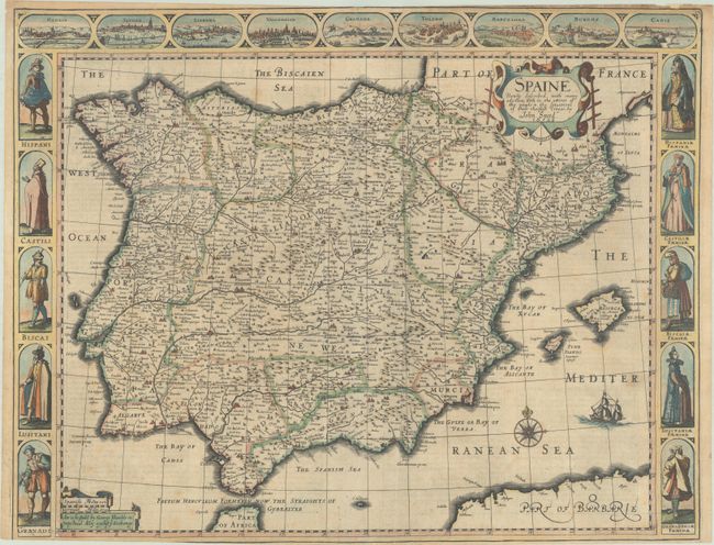
This lovely copper-engraved carte-a-figures map covers the Iberian Peninsula and is one of the most visually appealing seventeenth-century maps of Spain and Portugal. The frieze across the top includes city plans of Madrid, Seville, Lisbon, Valladolid, Granada, Toledo, Barcelona, Burgos, and Cadiz. The side panels feature costumed figures of the major regions: Hispani, Castili, Biscai, Luistani, and Granadi, with men on the left and women on the right. The English text on the verso has a description of the region, people and history as seen through eyes of a Jacobian English historian. This is an early edition published by George Humble in pops-head Alley against ye Exchange, published between 1627-32.
References: Shirley (BL Atlases) T.SPE-2a #12.
Condition: B+
A sharp impression on a lightly toned sheet with a bunch of grapes watermark, an extraneous vertical crease, and light soiling. Trimmed by the bookbinder with loss of part of the neatline at bottom left and overall very narrow remaining margins at top and bottom. A small chip at top right and a short tear at bottom center have been archivally repaired.