Subject: Paris, France
Period: 1830 (dated)
Publication:
Color: Hand Color
Size:
40.2 x 28.9 inches
102.1 x 73.4 cm
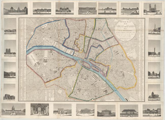
This wall-sized folding map centers on a large bird's-eye plan of Paris, surrounded by 22 vignettes of important buildings in the city. Paris is divided into 12 arrondissements, and both streets and important locations are labeled. An alphabetical list of place names with grid coordinates flanks the map. The vignettes surrounding the map depict the Louvre, Hotel de Ville, Notre Dame, Porte Saint-Denis, the Hotel des Invalides, Saint-Sulpice, and other key landmarks. The vignettes were printed from separate plates onto separate sheets and pasted onto the central map. Drawn by Richard, engraved by Bonnet, and published by Troude and Terry.
References:
Condition: B+
A sharp impression, issued folding, and now flattened and professionally backed in archival tissue to repair some short separations and small holes along the folds, with very minute losses. There is light toning and soiling, primarily along the folds.