Subject: French Alps
Period: 1682 (published)
Publication: Theatrum Statuum...Sabaudiae Ducis
Color: Black & White
Size:
23.6 x 19.9 inches
59.9 x 50.5 cm
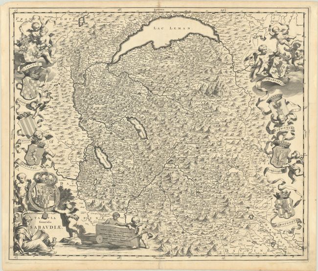
This handsome map depicts the Duchy of Savoy, including much of Switzerland along with portions of eastern France ad western Italy. It extends from Lake Geneva south through the Alps including the cities of Lausanne, Bonneville, Annecy, Belley, Susa and more. The region's coats of arms prominently flank the map and are held aloft by cherubs. The map is further decorated by a title cartouche on plinth and distance scale on stone. Engraved by Joannes de Broen. Published in Blaeu's atlas of the states of Savoy.
References: Van der Krogt (Vol. IV) #4770.
Condition: B+
A crisp impression with an archivally repaired 3.5" centerfold separation at bottom.