Subject: Northern France
Period: 1670 (circa)
Publication:
Color: Hand Color
Size:
21.6 x 18.1 inches
54.9 x 46 cm
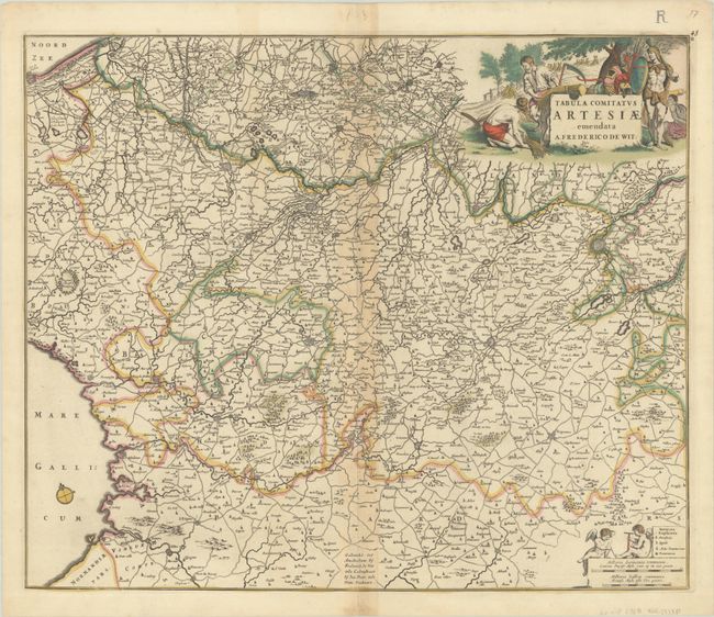
A decorative map of the northern province of Artois on the border with Belgium. It is fully engraved to illustrate fortified cities, forests, rivers, roads, and villages. The detail of roads is extraordinary for a map from this period. The map includes the fortified cities of Ardres, Saint-Omer, Cassel, Douai, and Arras. The title cartouche features an ancient Frank warrior on one side, and a peaceful scene of farmers harvesting wheat on the other. This is the second state, with an engraved "R" added at top right.
References: Carhart #138.
Condition: B+
A sharp impression with full contemporary color, light toning along the centerfold, and an archivally repaired centerfold separation at bottom.