Catalog Archive
Auction 207, Lot 445
Shows French Colonial Possessions in the Americas
"Totius Galliae cum Provinciis Finitimis et Partibus in America Conquisitis Geographica Descriptio", Scherer, Heinrich
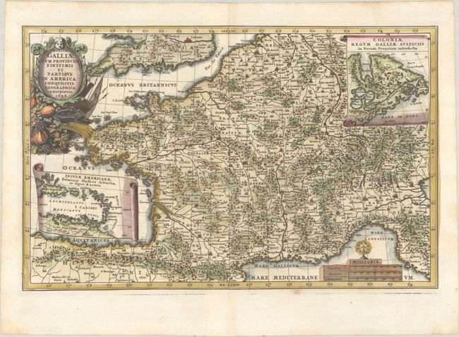
Subject: France, Canada & Caribbean
Period: 1698 (dated)
Publication: Atlas Novus
Color: Hand Color
Size:
13.5 x 8.6 inches
34.3 x 21.8 cm
Download High Resolution Image
(or just click on image to launch the Zoom viewer)
(or just click on image to launch the Zoom viewer)