Subject: Low Countries
Period: 1676 (published)
Publication: Introductionis in Universam Geographiam
Color: Hand Color
Size:
9.9 x 7.1 inches
25.1 x 18 cm
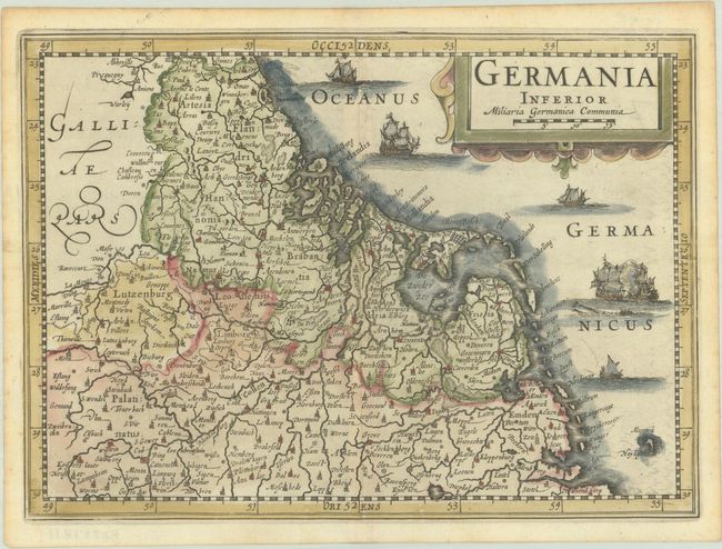
This lovely small map of the Low Countries is oriented with north to the right. The map is filled with place names and ships fill the North Sea. Originally engraved by Pieter van den Keere, this is the second state with his name removed from the title cartouche and the moire-pattern removed from the seas (although still faintly visible in a few spots). This map was originally engraved for Cloppenburgh's edition of Mercator's Atlas Minor, and later used for an edition of Cluver's Introductio in Universam Geographicam.
Cluver's Introductio in Universam Geographicam was a popular atlas, appearing in over 45 editions during a 100-year period. The first edition was published without maps in the 1620s, and the first edition to include maps was published circa 1641. The various editions were published in different cities throughout Europe, including Amsterdam, Nuremberg, and London, often with new sets of maps engraved. This map is from an Amsterdam edition published by Jansson's heirs, which included some maps from Jansson's Atlas Minor.
References: Shirley (BL Atlases) T.CLUV-6a #9; Van der Krogt (Vol. III) #3000:353.1.
Condition: A
A crisp impression on a watermarked sheet with light toning along the edges.