Subject: Northern Netherlands
Period: 1647 (circa)
Publication: Toonneel des Aerdrycks
Color: Hand Color
Size:
20.9 x 15 inches
53.1 x 38.1 cm
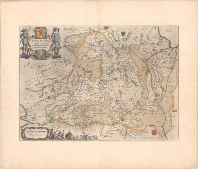
This exquisitely engraved map depicts the province of Drenthe in the northeastern part of the Netherlands. The map identifies the fortified cities of Coevorden, Meppel, and, just outside the province's boundaries, Steenwijk, Groningen, and Winschoten. There is excellent detail of the region's rivers, canals, roads, and topography, with pictorial representations of the forests and heathlands. Three coats of arms decorate the map. The ornate title cartouche features two hunters with their dogs and a slain boar between them, with the Leo Belgicus and Drenthe's coats of arms. Next to the distance scale cartouche is a scene of idling farmers and their sheep. Dutch text on verso, published between 1647-61.
References: Van der Krogt (Vol. II) #3850:2.1.
Condition: A
A dark impression with full contemporary color on a sheet with wide margins and a large watermark of the god Atlas. There is some printer's ink residue, light foxing that is mostly confined to the blank margins, and a short centerfold separation at bottom.