Subject: Denmark
Period: 1626 (dated)
Publication: A Prospect of the Most Famous Parts of the World…
Color: Black & White
Size:
20.3 x 15.5 inches
51.6 x 39.4 cm
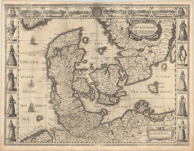
This superb map of the Kingdom of Denmark covers the region that includes Terra Scania on the southern coast of present-day Sweden and Schleswig-Holstein. This is one of only three carte-a-figures map of Denmark. The top panel includes the portraits of King Christian IV and King Frederick III, the royal coat of arms and bird's-eye views of notable places including Copenhagen, Elsinore, Landscroon, Ripe, Schleswig and Hamburg. The side borders illustrate different levels of Danish society with costumed figures. On the verso is English text containing a description of the kingdom. This is an early edition with the imprint of George Humble in Popshead Alley in the cartouche, published between 1627-32. Engraved by Evert van Hamersveldt Symons.
References: Shirley (BL Atlases) T.SPE-2a #15.
Condition: B+
A crisp impression on paper with a bunch of grapes watermark. There is a 1.75" archivally repaired centerfold separation at bottom, a small rust spot at right, and a minor crease at bottom left.