Subject: Baltic, Latvia & Estonia
Period: 1716 (circa)
Publication:
Color: Hand Color
Size:
23.1 x 19.3 inches
58.7 x 49 cm
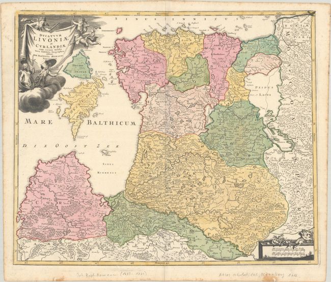
This attractive map of Estonia and Latvia shows the fortified towns of Riga, Goldingen (Kuldiga), Pernow (Parnu), Hapsal (Haapsalu), Derpt (Tartu), and Narva and is filled with hundreds of tiny villages, forests, marshes, mountains, and rivers. The islands of Oesel (Saaremaa) and Dagho (Hiiumaa) are prominent in the Gulf of Riga. The sheet is decorated with a drape-style title cartouche held aloft by weapon-wielding putti and a scale cartouche in the opposite corner.
References:
Condition: B+
A dark impression with full contemporary color on a bright sheet with the spearhead watermark of Elias Kutter. There is an extraneous crease along the centerfold, an archivally repaired centerfold separation at bottom, two short worm tracks in the bottom margin that have been repaired, and foxing along the edges of the sheet.