Subject: Baltic, Latvia & Estonia
Period: 1639 (circa)
Publication:
Color: Hand Color
Size:
20.4 x 15.4 inches
51.8 x 39.1 cm
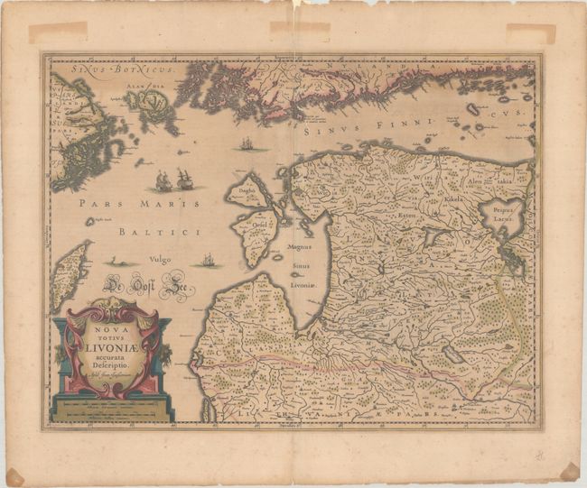
Superb map of Estonia and Latvia providing good information on the rivers, forests, lakes, islands, and cities. A large title cartouche, sailing ships, a sea monster, and wonderful calligraphy decorate the map. Jan Jansson (1596-1664) was a Dutch cartographer and the son-in-law of Jodocus Hondius. A globe maker, he published an edition of Ptolemy's works in 1617, and he and his brother-in-law, Henricus Hondius, published the Atlas Novus in 1637. At Henricus Hondius' death in 1657, he inherited the Hondius publishing firm. French text on verso, published between 1639-49 in either Nouveau Theatre du Monde or Nouvel Atlas ou Theatre du Monde.
References: Van der Krogt (Vol. I) #1710:1B.1.
Condition: B
A nice impression with full contemporary color on a lightly toned sheet. There is a centerfold separation and associated tear entering 3.5" into map image at top that have been closed with archival materials on verso. In the map image there are faint manuscript ink notations at top right and a couple tiny holes. Old tape stains appear in the blank margins (the tape was previously removed).