Subject: Southern Sweden
Period: 1740 (circa)
Publication:
Color: Hand Color
Size:
22.8 x 19.5 inches
57.9 x 49.5 cm
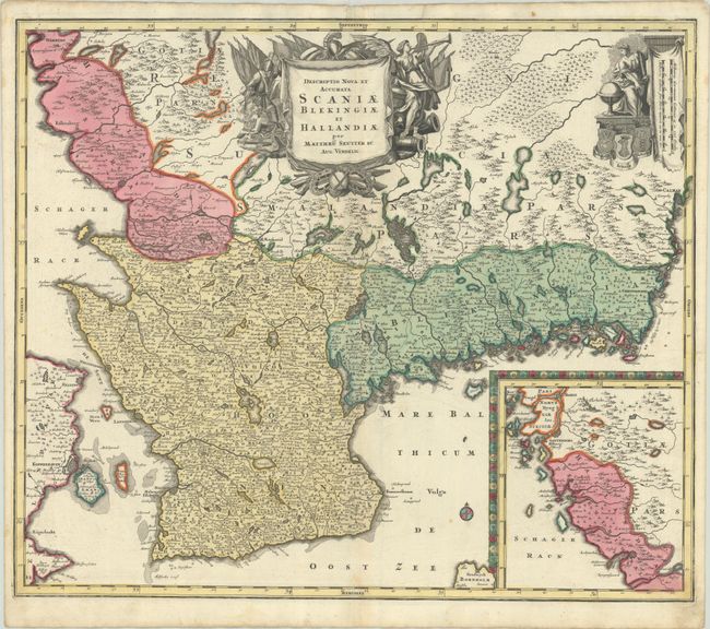
This superb map of southern Sweden extends west to show Copenhagen in Denmark. A large inset at lower right features Halland, a portion of West Gothland, and a small part of Norway along with the fortified cities of Gothenberg and Warberg. The map is adorned by a military-themed title cartouche and distances scales adjacent to a female figure studying a globe. This map appears to be based upon Frederick de Wit's earlier map entitled Accurata Scaniae, Blekingiae, et Hallandiae Descriptio (1682) with updated decorative elements.
References:
Condition: A
A crisp impression with contemporary color and a bit of soiling in the corners. Two tiny edge tears at top have been repaired with archival tape on verso.