Subject: Southwestern Wales
Period: 1662 (dated)
Publication: The Theatre of the Empire of Great Britaine...
Color: Black & White
Size:
19.9 x 15.1 inches
50.5 x 38.4 cm
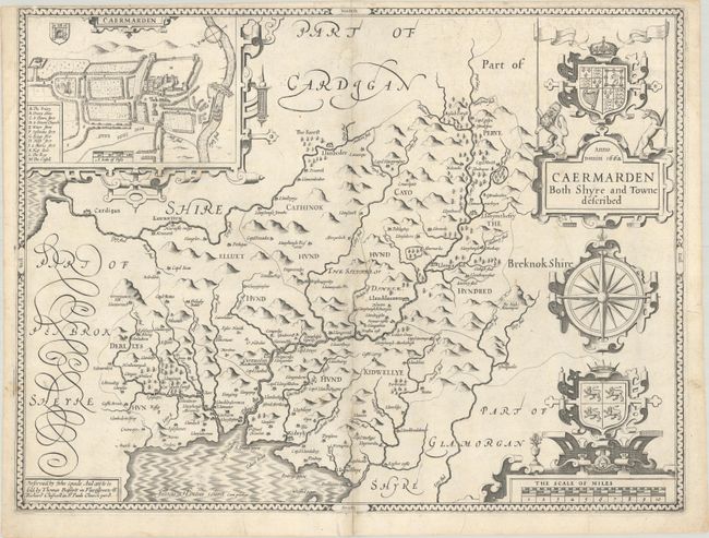
This is a classic decorative county map from John Speed’s important English atlas. Besides presenting the most up-to-date information in his maps, Speed also included detailed city plans; in this instance of the town of Carmarthen. This plan shows St. Peter's Church, the largest parish church in Wales, as well as the River Towy with two ships sailing through. The map is decorated with the royal coat of arms, the coat of arms of Llywelyn the Great, a compass rose, and a distance scale. Engraved by Jodocus Hondius. Published circa 1676 with the imprint of Bassett and Chiswell at bottom left. Blank verso.
References: Shirley (BL Atlases) T.SPE-1k.
Condition: B+
A crisp impression on a bright sheet with a bunch of grapes watermark. There are two small repaired holes in blank areas along the centerfold with a miniscule amount of missing image at center. Two small tears in the bottom blank margin have been closed on verso with archival tape.