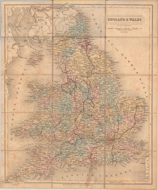
Subject: England & Wales
Period: 1837 (dated)
Publication:
Color: Hand Color
Size:
12.9 x 15.7 inches
32.8 x 39.9 cm
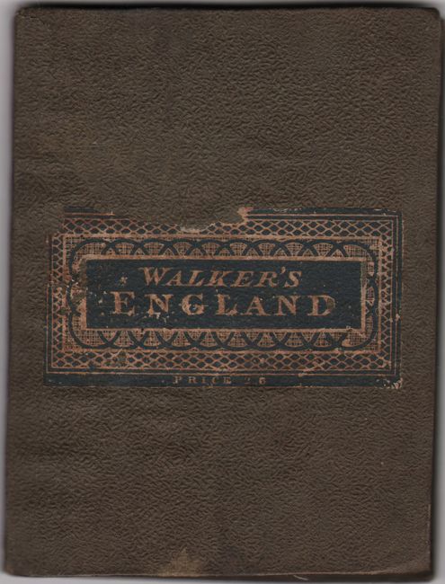
This nicely detailed pocket map shows the counties of England and Wales. A network of railroads radiates out from London, and roads are delineated as well. The map spans as far north as Edinburgh and Glasgow and extends to show portions of the coast of Ireland. Dissected and backed in linen. Published in London by Longman, Rees, Orme, Brown & Co. Folds into brown cloth boards with the title Walker's England (3.8 x 4.9").
References:
Condition: B
Issued folding with light toning and offsetting, a stain at bottom, and a few white spots. There are tiny separations along the linen folds. Covers are lightly soiled and worn and the title plate is chipped.