Subject: London, England
Period: 1870 (circa)
Publication:
Color: Printed Color
Size:
21 x 16.8 inches
53.3 x 42.7 cm
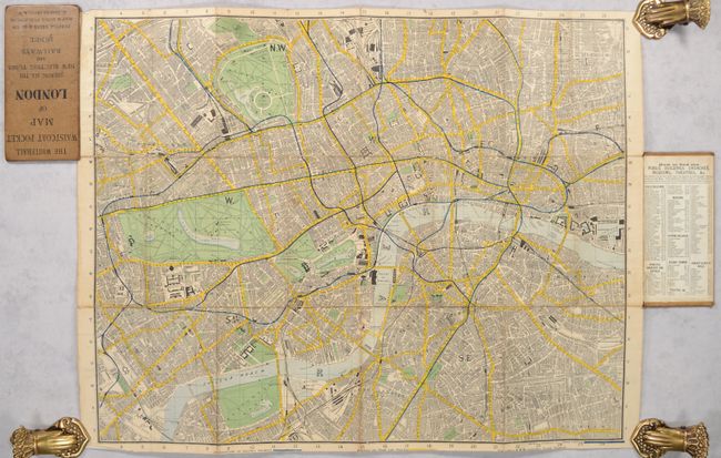
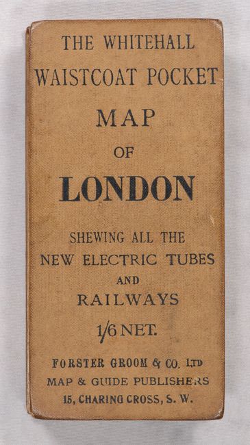
This detailed pocket map of London was published by Forster Groom & Co. at Charing Cross. It extends from Kensington Park east to the London Docks, and from the Great Northern Railway Depot south to beyond Battersea Park. The map presents the street grid pattern, parks, numerous important buildings, and a color-coded legend at bottom to identify railroads, street car lines, and the underground railways or "new electric tubes and railways." The map folds between two separate cloth boards.
References:
Condition: B+
Issued folding and backed with contemporary linen. There is light wear along the fold lines, some fold separations, and the bottom margin has been trimmed slightly into the key beneath the map. Covers have light soiling.