Subject: Central England
Period: 1637 (published)
Publication: Camden's Britannia
Color: Hand Color
Size:
12.3 x 10.4 inches
31.2 x 26.4 cm
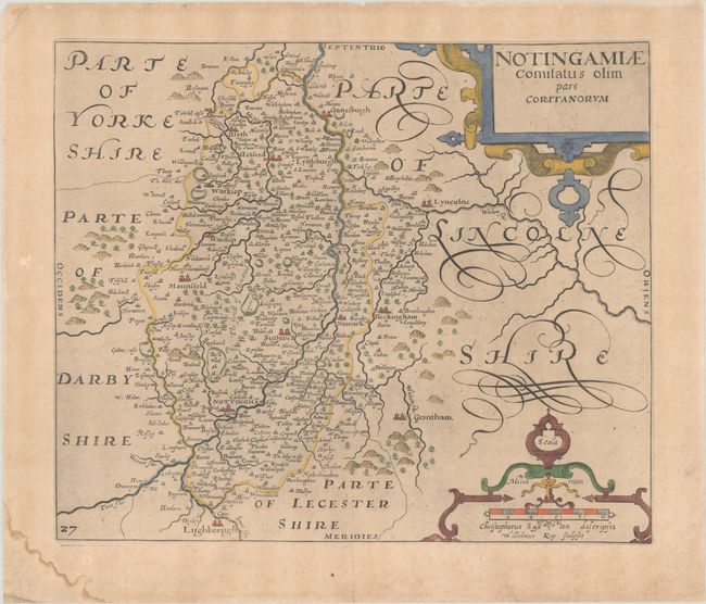
An early map of the county of Nottinghamshire engraved by William Kip and based upon the famous survey by Christopher Saxton. The map shows the city of Nottingham at bottom center, and extends south to Loughborough, east to Lincoln, and north past Gainsborough. Numerous tiny towns are labeled, with rivers, mountains and forests well depicted. The map is adorned with two strapwork cartouches. Published in the 1637 edition of Camden's Britannia, with the addition of a plate number at lower left.
References: Shirley (BL Atlases) T.CAMD-1e.
Condition: B+
On watermarked paper with light toning, minor creasing adjacent to the lower centerfold, and a small stain confined to the bottom margin.