Subject: Europe
Period: 1639 (circa)
Publication: Nouveau Theatre du Monde
Color: Hand Color
Size:
20.8 x 14.7 inches
52.8 x 37.3 cm
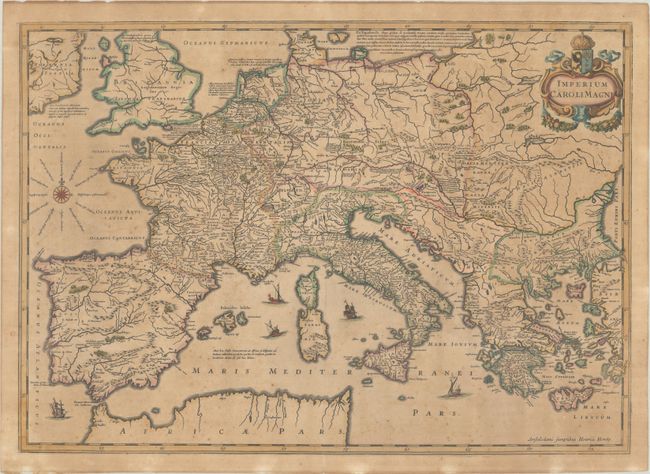
This is a superb historical map depicting the European empire of Charlemagne, King of the Franks and Emperor of the Holy Roman Empire, 742 - 814. The map covers all of Europe and the Mediterranean, excluding Scandinavia. The map is fully engraved with mountains, forests, and cities and notations in Latin concerning Charlemagne's exploits. A title cartouche with wreath and coat of arms, compass rose, and five sailing ships decorate this beautiful map. French text on verso, published between 1639-49.
References: Van der Krogt (Vol. I) 1050H:1.1.
Condition: B
Contemporary outline color on a toned sheet with light foxing.