Catalog Archive
Auction 207, Lot 380
Full Contemporary Color
"Insulae de Cabo Verde, olim Hesperides, sive Gorgades: Belgice de Loute Eylanden", Jansson, Jan
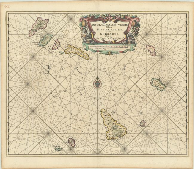
Subject: Cape Verde Islands
Period: 1675 (circa)
Publication:
Color: Hand Color
Size:
21.6 x 17.2 inches
54.9 x 43.7 cm
Download High Resolution Image
(or just click on image to launch the Zoom viewer)
(or just click on image to launch the Zoom viewer)