Catalog Archive
Auction 207, Lot 377
"Les Isles Terceres", Duval, Pierre
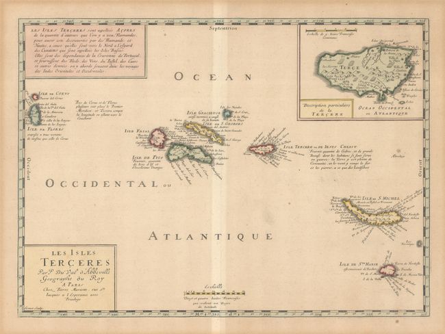
Subject: Azores
Period: 1654 (circa)
Publication: Cartes Geographiques...
Color: Hand Color
Size:
17.6 x 12.8 inches
44.7 x 32.5 cm
Download High Resolution Image
(or just click on image to launch the Zoom viewer)
(or just click on image to launch the Zoom viewer)